
Monday June 15th 2009. After two thunderstorms and a brief funnel cloud observed from Maghera during the early afternoon things were now beginning to quiet down. Back at home the radar showed the N section of N. Ireland clearing up with showers and storms completely dying out. During the late evening time solar heating was still very strong and high CAPE values were still over the country until sunset so I made a mental note to keep an eye on any remaining convection which might fire up and take advantage of these good conditions. From home I caught a glimpse of a stunning cell developing to my NE which seemed extremely energetic and photogenic in equal measure. From looking at the huge size and speed of those updraughts I felt confident that there was a high risk of a funnel cloud developing, however my view of the base was restricted by houses. At that moment in time my friend, Ryan McDonald, called around for a chat, and thinking about the cell I suggested that we went for a walk to a location with a good view of the NE so I could keep an eye on it, I trusted my instincts and took my camera with me too.
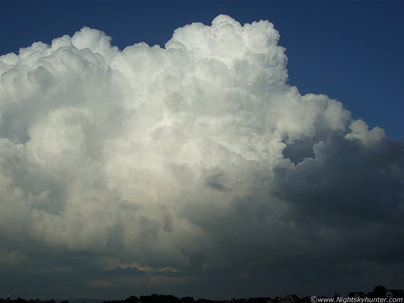
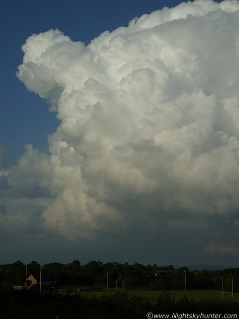
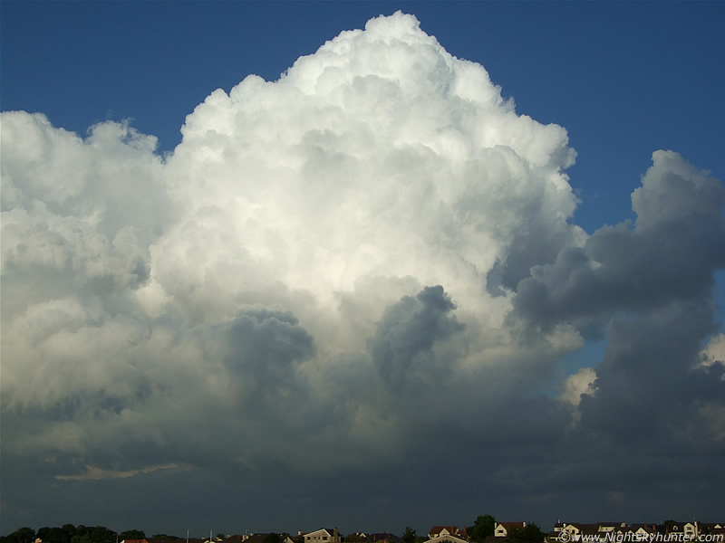
It was a very pleasant evening, very warm and sunny with a few towering cumulus clouds going up in the late evening Sun, however by far the most impressive of these was this one I had been watching which was located over the countryside in the NE sector of Maghera, and moving very slowly to the SE. It was crossing by us from L to R almost at a Snail's pace so we had a great view of it. During the entertaining conversation between us I kept looking back at the cell, and every time I did so it seemed to get better and better. There came a point when our conversation stopped and we admired this enormous cell. It was a series of towering cumulus (updraughts) with a huge central updraught tower which was back-building from behind. The cell was extremely solid and sharp in profile with exploding towers going up at centre, rear, and even the sides which looked beautiful in the lowering Sun angle. It was then that I noticed something forming at the base of the cell directly below the main central updraught. At first I was uncertain, but soon it became more obvious, it was a funnel cloud.
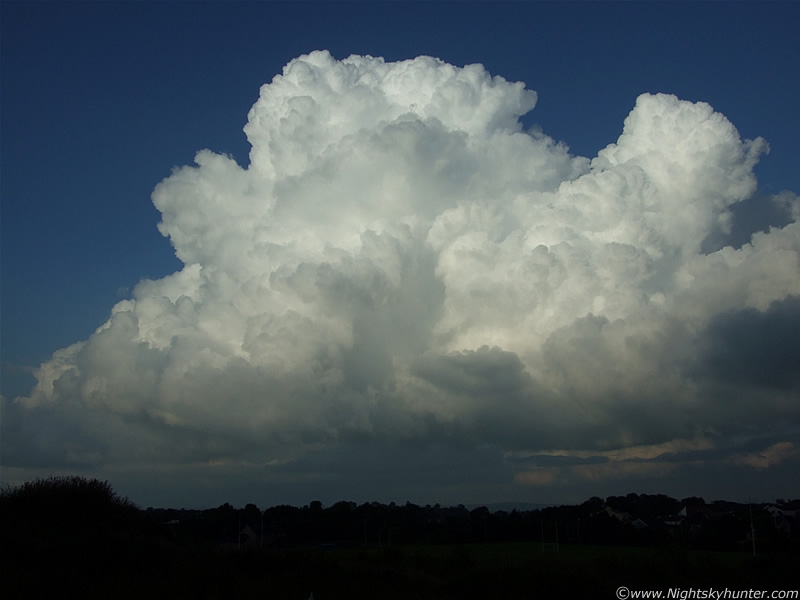 |
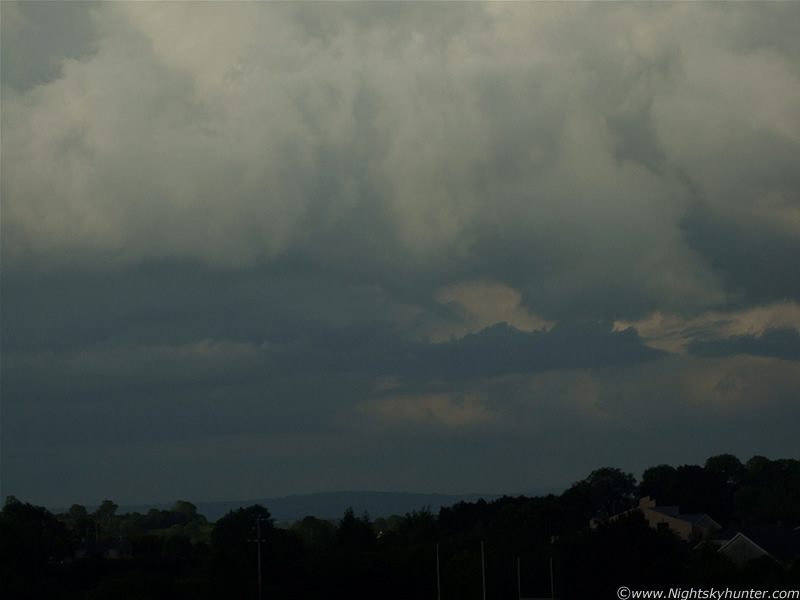
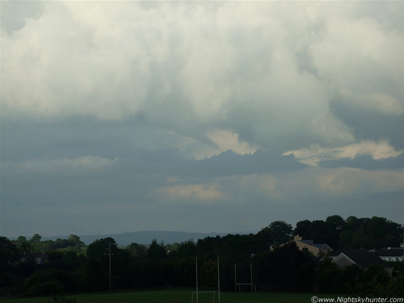
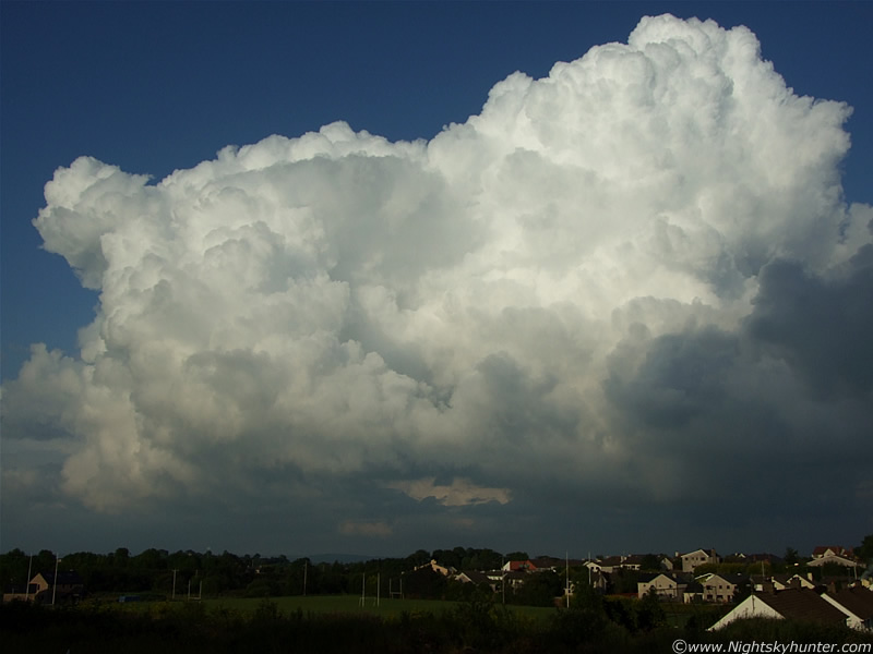
Here's that beautiful cell in the NE. Look at the central base directly below the tallest tower and you will see a small lowering, that's the funnel at it's earliest stage.
 |
Ryan and I could see a tan coloured (with a hint of white) funnel very easily with the naked eye despite its considerable distance from us. At first it looked like a substantial inverted cone, broad at top, slender below, and it was changing shape and size in real time.
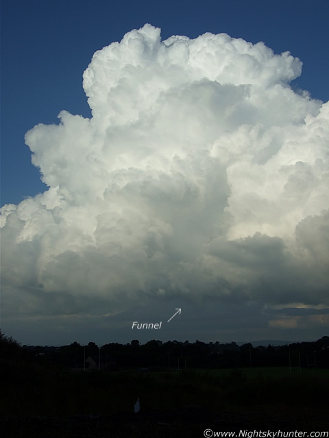 |
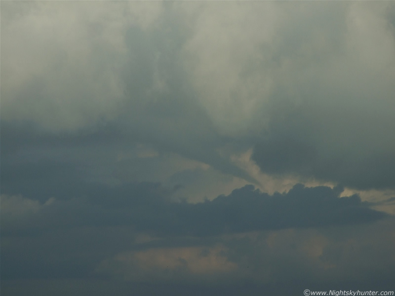
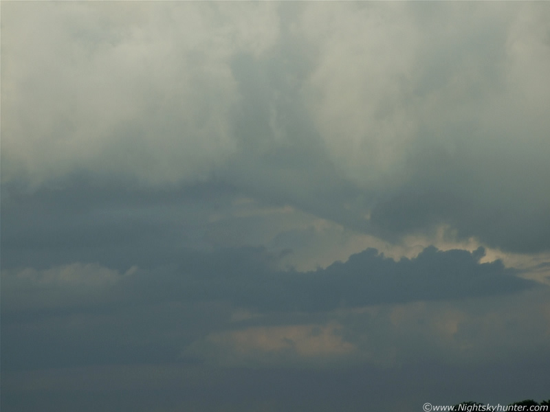
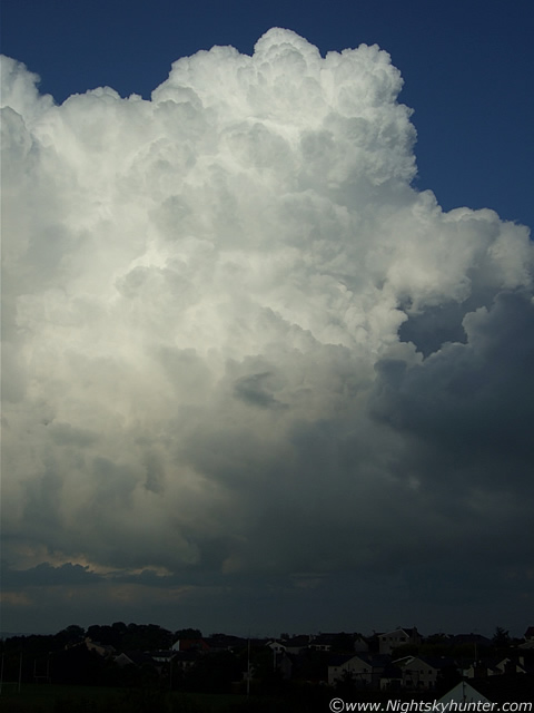
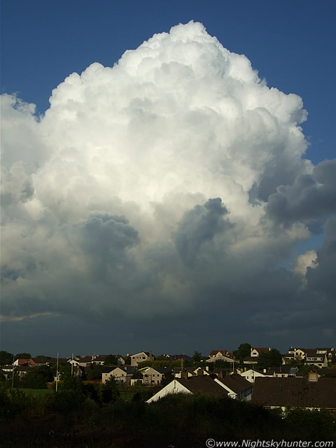
I deliberately took these earlier images at wide angle because I wanted to show the funnel and the entire cell at the same time, as a result the funnel seems smaller and less obvious than it actually was but at least you can see the entire structure in the one frame. These images are not great because I was taking them hand held and should have brought my tripod out with me which was a mistake, however at least I got a record of it. While I was attempting to take images of the funnel Ryan was commenting on what he was seeing visually which I found extremely helpful. It's at times like this that it's very productive to have someone else with you to gather as much info as possible. As we watched, the cone went back up into the cell again, came back down into view, then repeated this pattern several times. After a few min's it began to rapidly change shape into a more slender form. The updraught/inflow region of the cell began to tilt the funnel into a horizontal position and try and merge it with the base.
 |
Slightly overexposed zoom shot. Slender funnel at centre and pointing down at a 45 degree angle to the lower R.
 |
Constantly changing shape and girth all the time while getting closer to the base. In this image it's longer than it seems. The funnel is extending to the upper L into that white cloud collar. It has several bends/kinks in it too.
 |
Another slightly overexposed image but the funnel is very plain to see. We could see this funnel lifting higher towards the base very easily at the time.
 |
Looking good now. No doubt about what this is.
 |
Look how straight the funnel is now!. After this it flattened against the base and vanished from view within the clouds. It may not seem like it from the images, but this was actually rather thrilling to watch, and to get it dropping from such a gorgeous cell in the first place was really special. How long did it last in total?, I'm not sure since time seems to pass differently when something exciting happens, however from start to finnish I would say around 10 min's, perhaps a little longer. This was also Ryan's first sighting of a funnel cloud which made it even more special. It's funny how things worked out because if Ryan had not called around when he did, we probably wouldn't have seen this funnel at all. It was the perfect climax to an action-packed threes over N. Ireland. During that three day period I experienced 8 thunderstorms and 3 funnel clouds which brings this years count to 12 thunderstorms and 5 funnel clouds which is my greatest number of events yet, and we still have the remainder of June, July, August, and September to look forward to.
 |
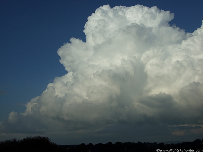
The funnel may have gone now but the beauty of this remarkable cell got better and better. The lower Sun angle produced wonderful depth, shadow, and structure to the updraughts of this cell which were still exploding up. Those tops were bubbling up and outward in real time so there must have been serious air currents inside this cell.
 |
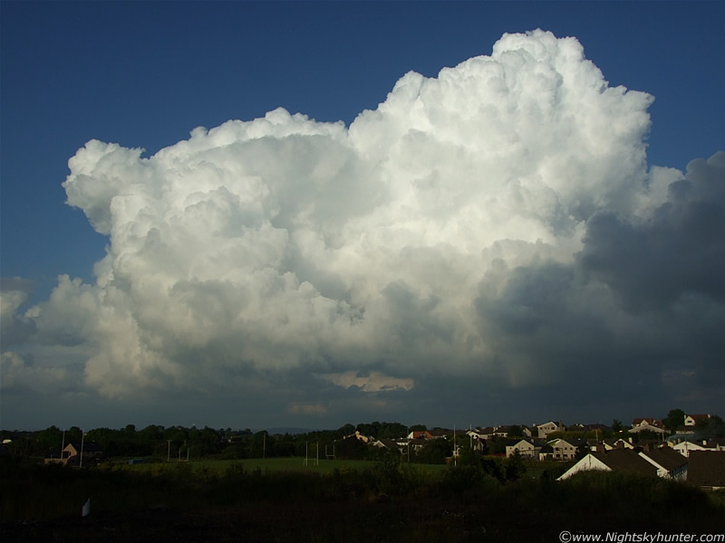
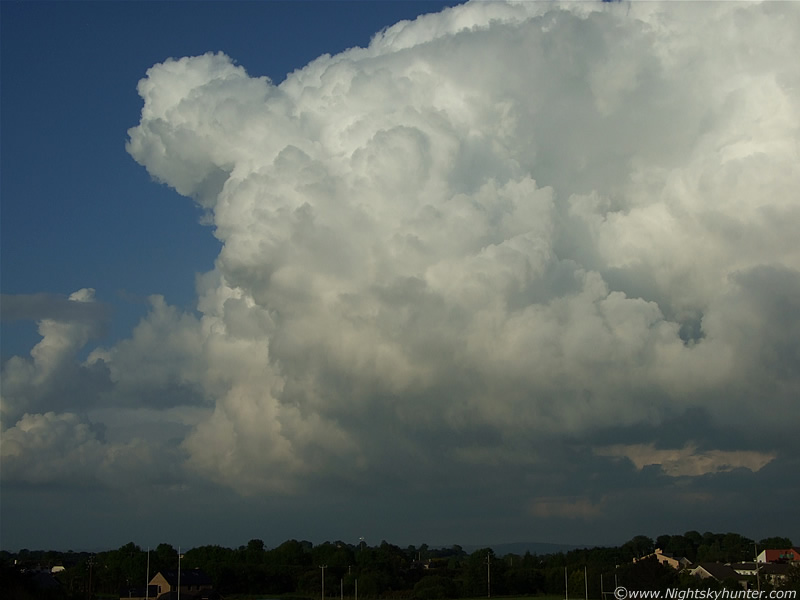
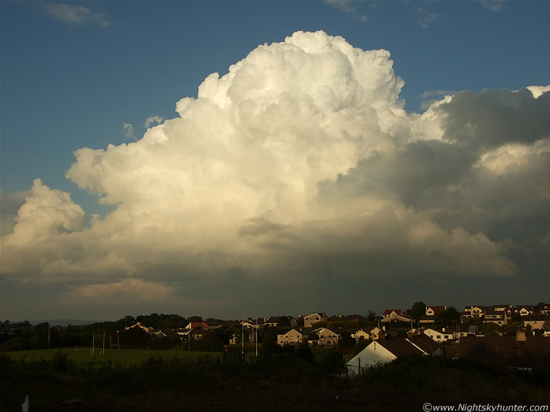
Look at the size of that in comparison to the houses below!. Now looking E. St. Patrick's pitch is in the foreground with the houses of Crewe Drive and Station Road below the cell.
 |
 |
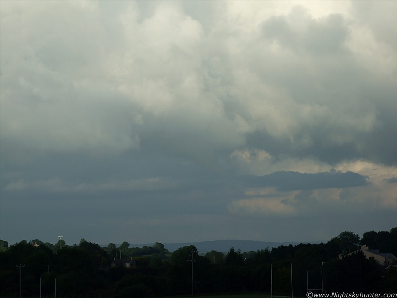
We kept watching it because there certainly was a good chance of spotting another funnel.
 |
When the central updraught tower would eventually collapse new towers would go up at the rear and feed into the cell and become the new central updraught. It was beautiful to watch, Mother Nature really is amazing.
 |
Rear of cell with another tower pushing up.
 |
I took many images during this session, and I have included a little too many on this account, it should have been split into two pages really.
 |
 |
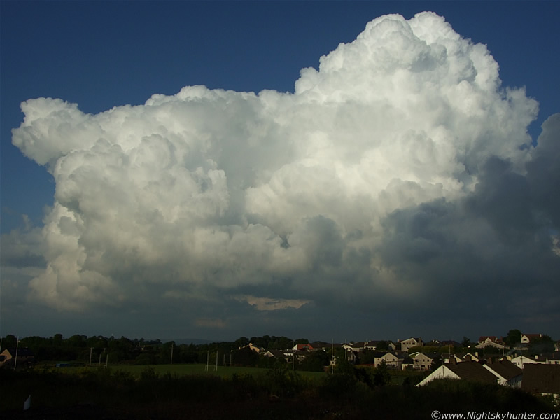
Look at the energy in that!. This has got to be one of the largest and finest quality towering cumulus clouds I have seen in a long time, at least since 2007 anyway. Back then, on the 18th, I recall seeing a stupendous cell from the same location, same area of sky, at around the same time, with a stunning overshooting top. I never did take images of it at the time though. The occupants of that house probably had no idea what was above them. There's no reason why another funnel or even weak tornado wouldn't drop from it.
 |
 |
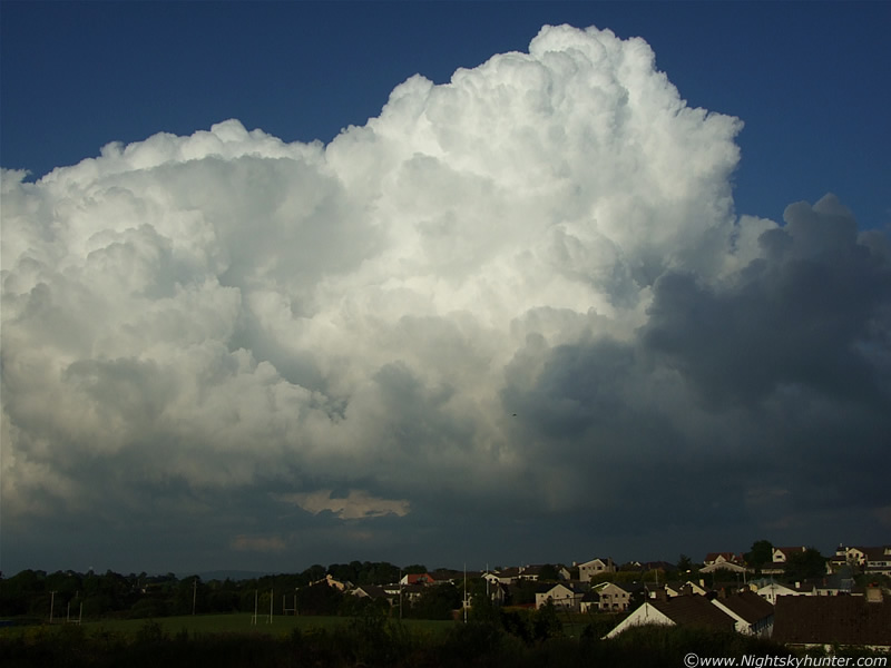
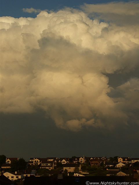
Still looking E but the cell is getting more distant. The lower Sun is producing a nice tan colour to the cell, and those updraughts are still going up strong. It felt like we had been watching this cell for a very long time.
 |
Last shot of the evening. Decaying rear of cell sporting a nice warm colour.
It had been a very successful day. Without doubt, this has been one of the best thunderstorm seasons I have experienced since to 2005 and 2006, and with high temps forecast for the next few weeks we may still get many more in the near future. Thunderstorms, and the incredible 2009 Notilucent Cloud season, are turning this Spring and Summer into the finest I have seen in years, both phenomena have already exceeded my expectations so anything else cool which appears now will just be a bonus. So, my plans are to catch more storms and the 'big one' - a spectacular funnel or tornado touch down here in N. Ireland. Exciting times are ahead!. Thanks for reading.
Martin McKenna